Wow! Been a minute since I’ve been ‘online’… very intentionally. I’d rather be out there living in the world! Than stuck in front of a computer screen. However, it’s a bitterly cold Winter day, and as I was scrolling through photos from the prior Summer, this collection came up, and I couldn’t help get all nostalgic and write about it. So for anyone curious about floating the North Fork in the future, here was our take. (all photos shot on iPhone)

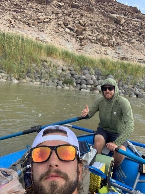
David jerry-rigs random crap onto our blue borrowed boat.
TRIP PREPARATIONS
We had a pretty janky trip, but it was ok. Everyone still had fun.
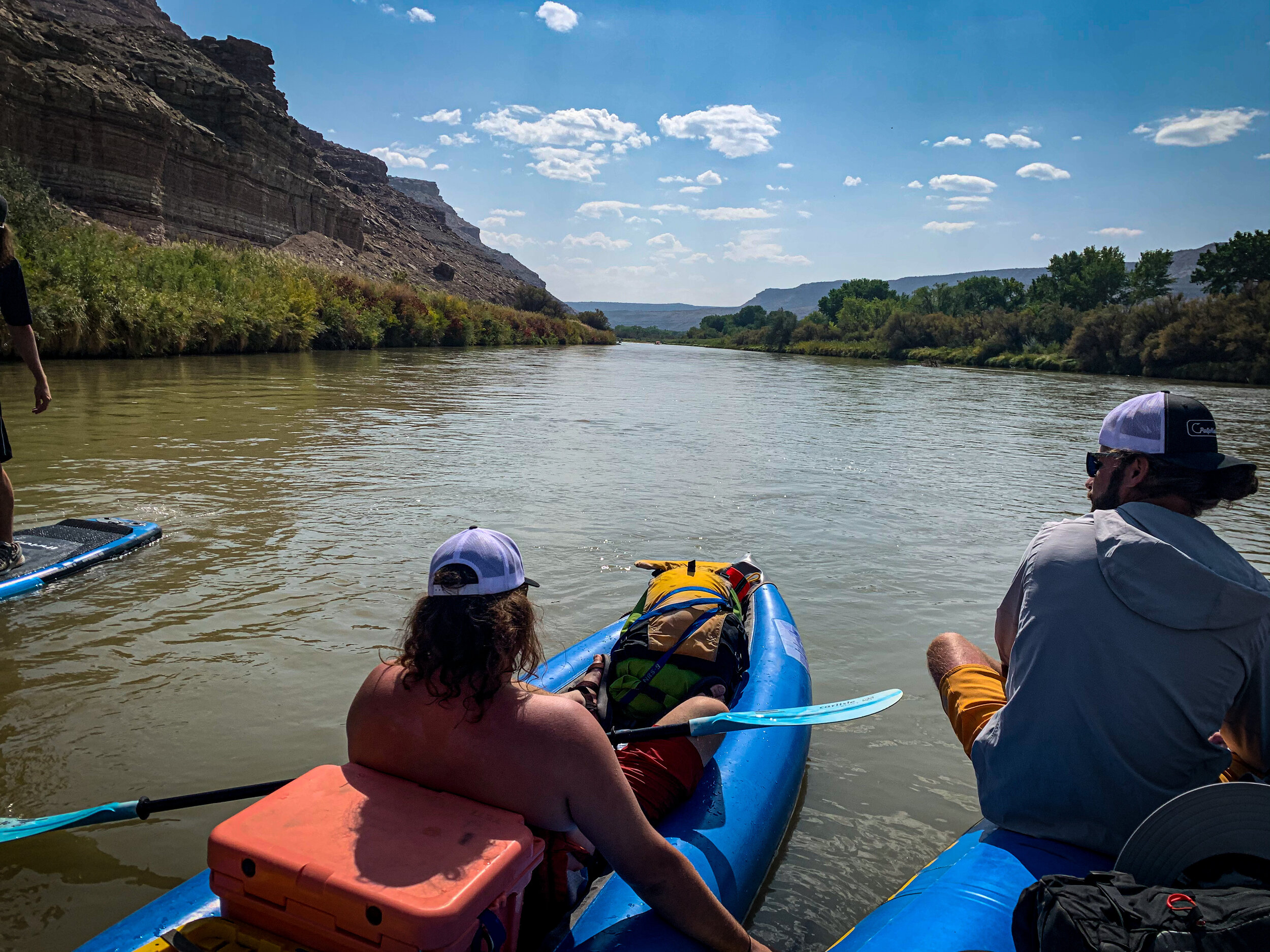
We had to make the best with the gear accessible to us- a 16’ stern frame oar rig we borrowed from the raft company I was working for (Thanks, Blue Sky Adventures!) a double ducky from a friend (thanks Matt) and my girlfriend’s paddle board. None of us had any fancy-pants river outfitting gear like two-burner stoves and tables and nice tents or even a groover (more on that later). We loaded up backpacking gear in dry bags and not-dry bags, removed a thwart, and strapped it all down into the raft with a mess of mismatching cam straps and p-cord. Rigged to flip? Glad we didn’t have to find out.
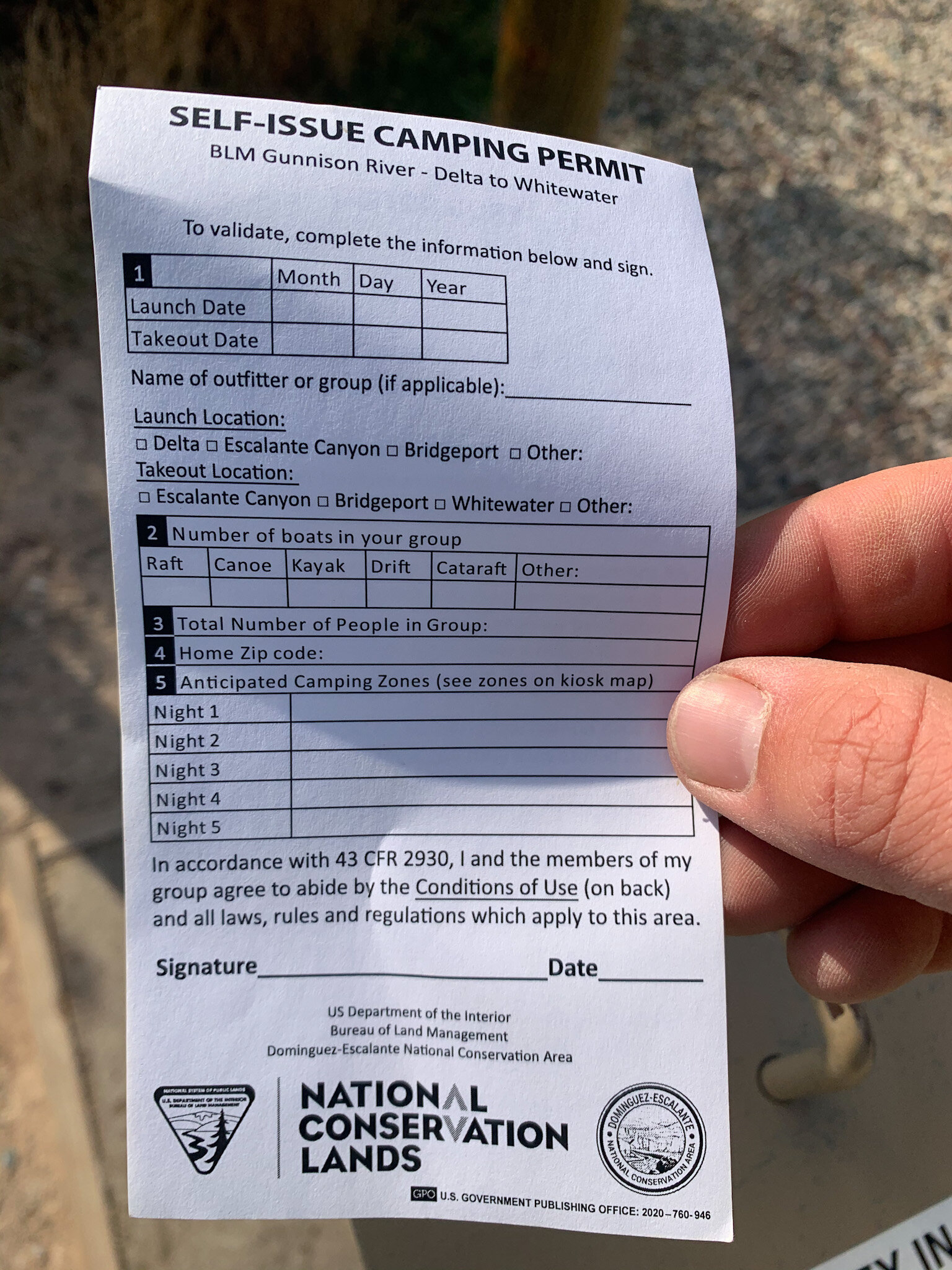
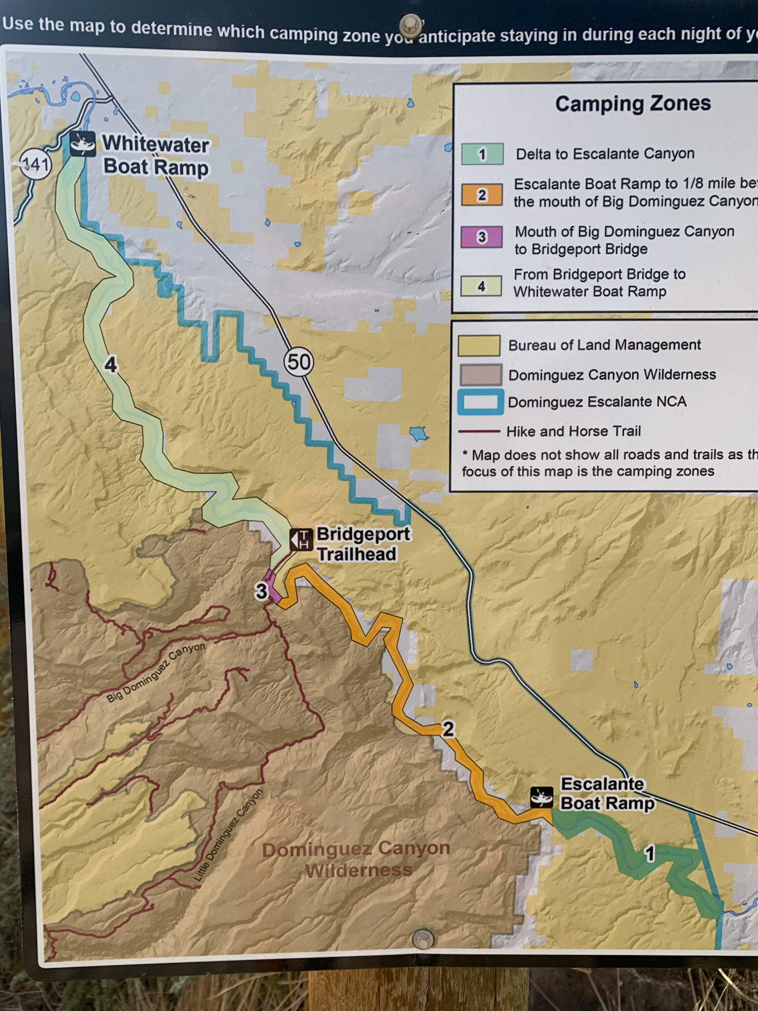
This stretch is permitted, although it’s a walk-up, self-serve permit located at the Escalante Canyon boat launch. This means you have to have a few things to be ‘legit’. A firepan (even though there was a fire ban in place?) and some way to deal with human waste- ideally, a groover. We had neither, and we were broke, so we decided to buy a huge foil turkey pan for our fire pan (legit) and just use wag bags for poo-poo (legit but a TERRIBLE idea). The fire pan worked just fine since we never used it- the wag bags were a source of dread once the started filling up. Using them is just fine- carrying them in a crate behind your seat on the ducky and catching a whiff of that sweet scent every time the wind shifts was a different story. Live and learn I suppose. Even for a group of 5 and two nights, I would definitely recommend renting a groover! There’s a place in Grand Junction that rents them (you’ll have to find them however, can’t remember the name).
Other than that, we just took simple gear that you would take on a backpacking trip, 15 gallons of water, a football, and a lot of beer. The only pain-in-the butt thing we had to do was arrange a shuttle for our vehicle. The folks at Western Slope SUP in Hotchkiss were super helpful with this. It was a little expensive, but they pick up your vehicle from the put in, drive it back to their place while you’re out, then deliver it to the Whitewater take-out a few hours before you arrive- limiting any risk for vandalism (that sadly occurs quite frequently in the area, from other reports I’ve heard).

Our campsite was more often than not a hot mess, although we always adhered to the Leave No Trace principles and cleaned up. Tents were definitely nice to keep the ‘skeeters at bay during the night.
EXPERIENCE
What an awesome, underrated float (don’t tell anyone that though).
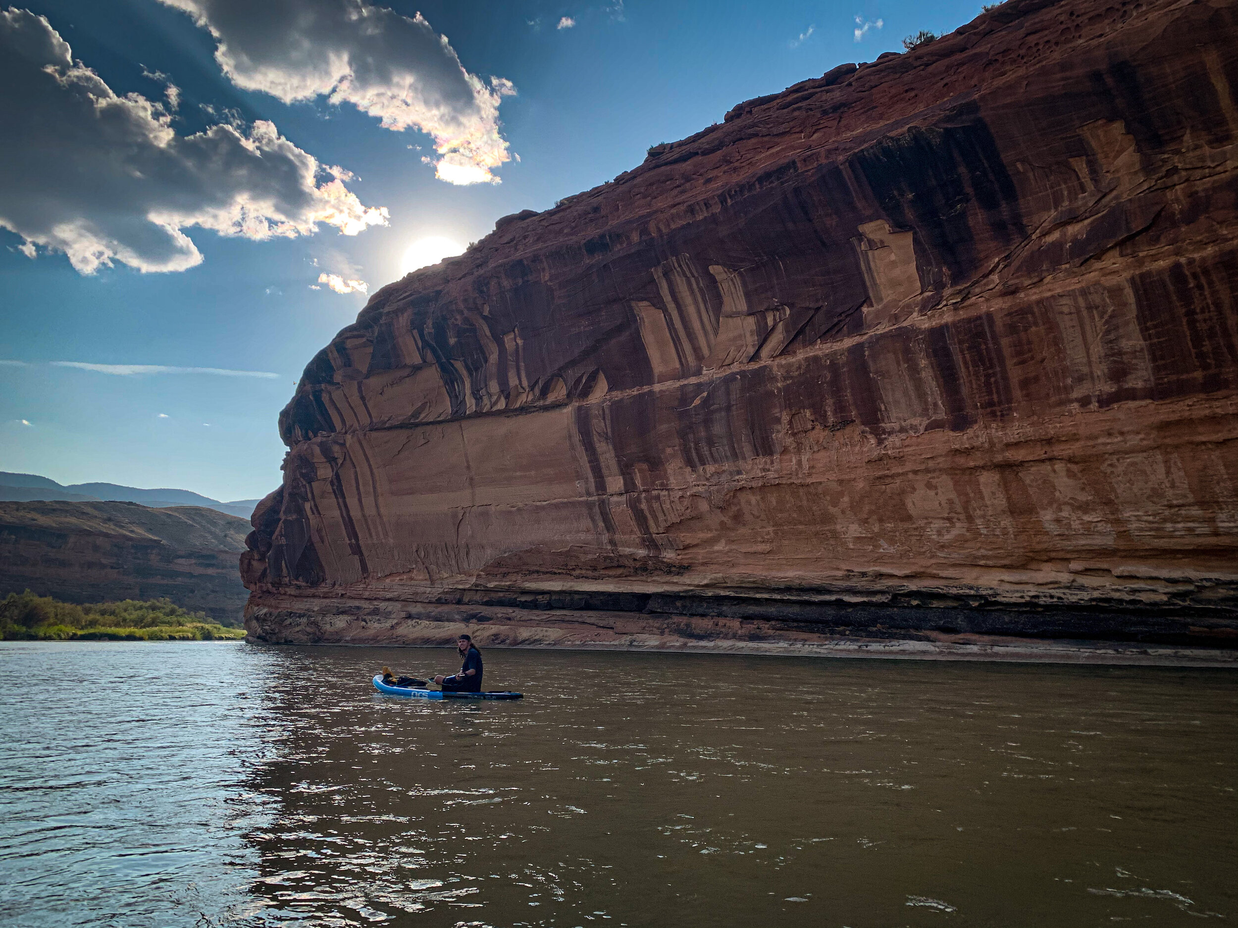
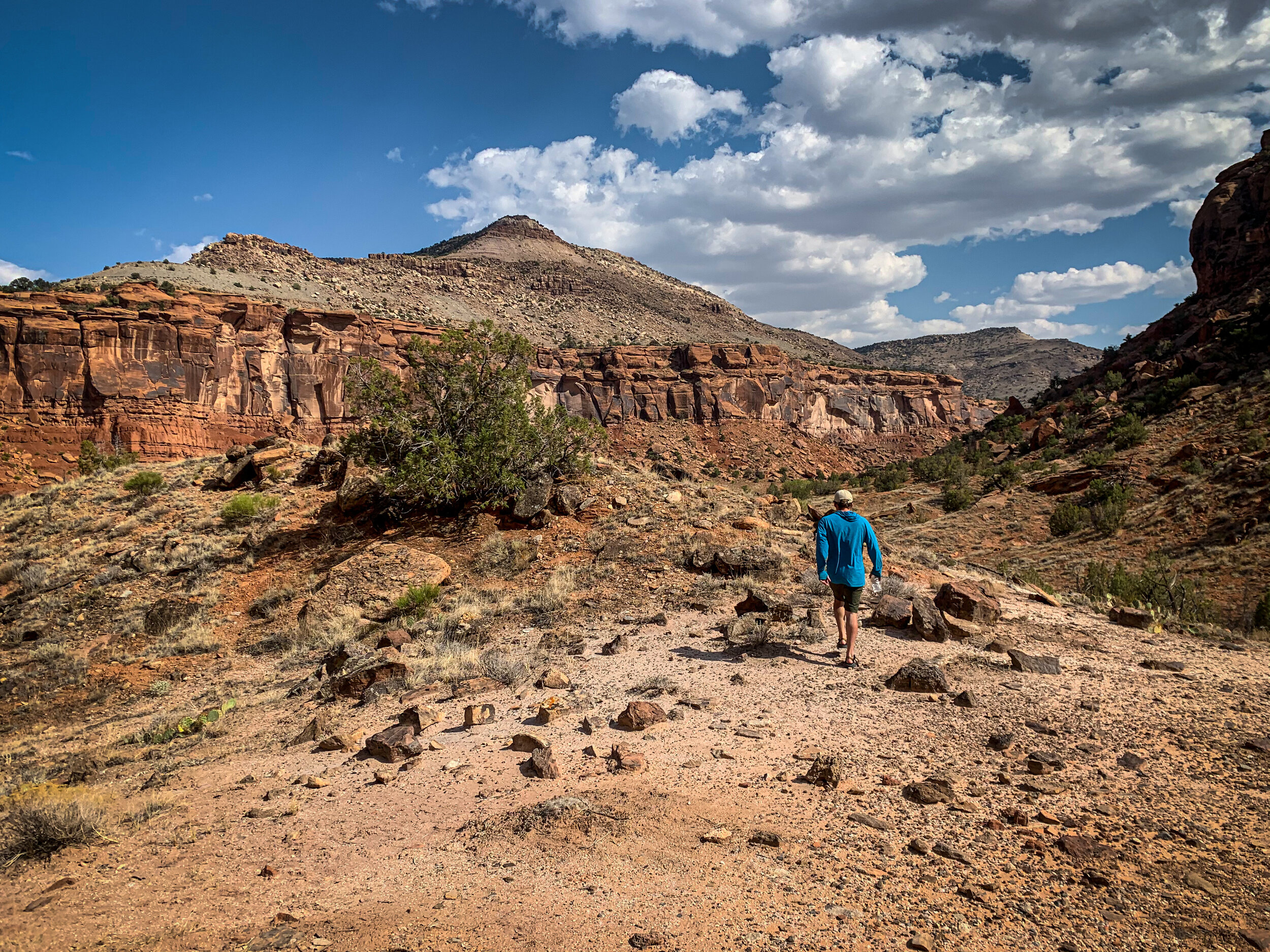
We were bummed out because all of the permits to Ruby-Horsethief were gone and the rivers were too low in other areas for multi-day trips (we went at the end of September). We were really just looking to get out on the river and have a peaceful float- and that’s what we got. No butt-clenching whitewater or scenic mountain vistas… just the calm and lazy North Fork meandering through the scrubby arid land of the Western Slope. It certainly has its own style of beauty, however. The towering red rocks of Big Dominguez canyon, the wide open sagebrush plains- the lack of noise! We felt so totally remote out there, even though you’re never more than a few miles away from Highway 50. The water is glassy and slow-moving in most places, with some little riffles and wave trains here and there. It was super fun taking a SUP along, and having a football to toss around. We took three days to float from Delta to Whitewater, and I’d say that was just about perfect. Although if I were to do it again, I’d consider a shorter trip- Escalante to Whitewater, or even Escalante to Big Dominguez, and spend more time exploring the canyon. Either way, it’s certainly a very cool area that offers a nice respite from the more trafficked recreation destinations on the Western Slope.

Mike poses next to a big ‘ol rock in Big D canyon.
BETA
Campsites are not marked on any maps and are pretty scarce until right before Big Dominguez Canyon. Make sure to bring along a map that has public/private land so you know where to camp.
For more planning, I used these resources:
Excellent trip report on Rootsrated: https://rootsrated.com/stories/canoeing-colorado-s-lower-gunnison-river-the-perfect-beginner-trip-on
BLM website: https://www.blm.gov/programs/national-conservation-lands/colorado/dominguez-escalante-nca